XenomatiX Road Data by XenomatiX

Transform Your Simulation with Accurately Measured Road Surface Data

XenomatiX Road Data enables Altair® MotionSolve® to simulate a multitude of pavements and road types, including highway, cobblestone, and off-road surfaces. Now, you can check how your mechanical system performs in real-world scenarios while considering road characteristics like coarseness, distresses, and elevation – all within an intuitive environment that utilizes a flexible, open interface.

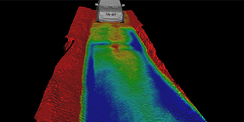
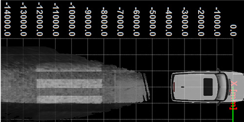
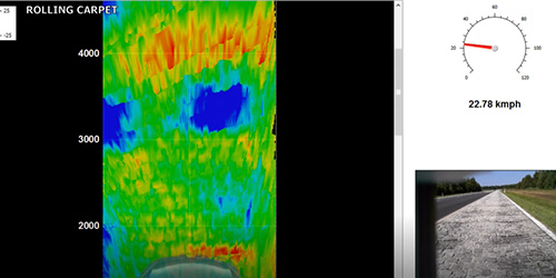
XenomatiX Road Data is digitalizing the world’s roads using true solid state LiDAR technology. The results are accurate, dense digital twins that users can utilize to analyze the reliability of cars, suspensions, and other mechanical systems. And MotionSolve users can now have access to an integrated library with a multitude of pavement types.

Why XenomatiX Road Data?

Accelerates Durability Analysis

XenomatiX Road Data simulates alternate highways, off-roads, and urban roads to improve your product and predict its reliability.

Increases Model Accuracy

You can model the specific roads that will be used for the vehicle testing and compare the simulated result with the physical data to improve your models.

Global Database Access

Road standards vary depending on local regulations. Now, you can now analyze how your vehicle behavior changes due to other countries’ and continents’ roads.

Key Features

Complete Road Characterization

Accurately represent pavement geometry such as waviness, roughness, lateral profile, rutting, and typical distresses.

High Accuracy and Resolution

With close to 500,000 data points per 10 meters of road, the data captures all necessary road features to properly represent the vehicle dynamics as they respond to things like cracks and other irregularities.

Vast Library of Road Types

You can now simulate any vehicle on a freshly paved highway or on old Belgian cobblestone. Additionally, you can test off-road vehicles on gritty, tough unpaved road scenarios.